Drone Imaging
At Biosense Institute we are using quadcopter DJI Inspire 1 to gain better insight into crop production and plan and manage agricultural operations more accurately. The technology can collect very high-resolution imagery below cloud level, with much more detail than the satellite imagery. The datasets include images captured with RGB and modified NDVI camera, but we are also using Flir thermal camera to make temperature measurements over large areas of heterogeneous terrain. Unmanned aerial vehicles are easy to use, as most mapping and data-collection missions are now conducted autonomously, by feeding the shape file of the desired area into the dedicated software.
For image stitching we use Pix4D and AgisoftPhotoscan software to generate high-resolution orthomosaics, vegetation index maps and DSMs (Digital Surface Models). These orthomaps are important layers of information and they can be integrated into GIS systems along with other layers derived from additional sources. These datasets are then processed and used for training of advanced machine learning algorithms.
BioSense uses UAS (Unmanned Aerial Systems) to detect nutrient deficiencies, pest infestations, water stress or excess and other conditions that affect crop development and improve the management of crops. They are especially useful for fields of a few dozens of hectares, such as orchards or vineyards, as scanning large fields of arable crops requires a lot of time. UAVs have also proven as effective tools for environmental monitoring, as they can cover medium-sized habitats and tell us more about the type of surroundings that insects and mammals grow in. The use of UAVs revolutionized spatial ecology and agriculture and allowed us to get high-resolution data and make optimal decisions with high accuracy.
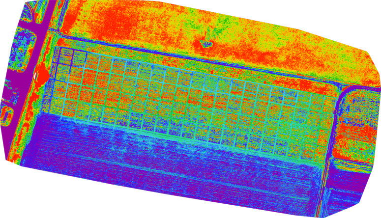
NDVI map of sugar beet crop