Satellite imaging
BioSense is the location of a Sentinel Data Hub and we are an active user of products from the ESA’s Copernicus programme. Before the launch of Sentinel satellites, our research was based on Landsat 7 and 8 and RapidView images, but today, it is mainly focused on data coming from Sentinel 1 and 2 missions. Images from Sentinel 2 are coming in 13 spectral bands, approximately every 5 days, depending on the cloud coverage, while Sentinel 1’s synthetic aperture radar allows for monitoring even in the case of clouds. This ensures continuous high-resolution monitoring of the environment and agricultural production in particular, throughout the growing season.
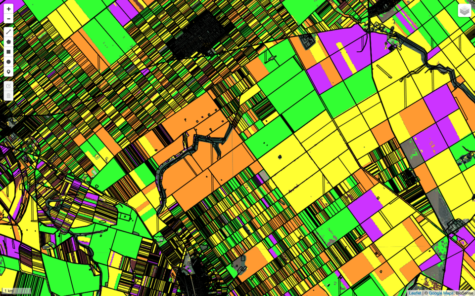
Since 2012, we have been producing land-cover maps for the Serbian province of Vojvodina, which distinguish fields of different crops, urban areas, forests and water bodies. This allowed us to map animal habitats, observe their change and capture the trends in crop rotation. Using the principles of data fusion, we reached the sub-pixel resolution using data sources with heterogeneous pixel grids. The second line of research is concerned with yield prediction. Based on the ground truth coming from field records, crowdsourced data and yield maps, we are training advanced machine learning models to estimate the yield. These models are based on more than 30 satellite vegetation indices, that incorporate the domain knowledge about the crops, and their accuracy is increased as plants progress through phenological stages. Vegetation indices are also excellent proxies for the damage assessment, as some of them are excellent proxies for damage caused by hail, drought or fire. This puts insurance companies among our partners, along with the government, research institutions and, nevertheless, the farmers, who are using our results to optimise the decisions concerning the time and amount of irrigation and distribution of fertilisers and pesticides.