Policy makers
BioSense has excellent ties with the Serbian Ministry of Agriculture and Provincial Secretariat for Agriculture, Water Management and Forestry of Vojvodina. We are providing a range of solutions that help public administration get a better insight into agricultural production, achieve more efficient control of the subsidies and detect irresponsible use of farmland.
Our solutions are mainly based on remote sensing and GIS and involve large databases of fields, farmers and acquired data. Services such as crop mapping over the region of interest are developed using Sentinel 2 satellite images and come at a 10m resolution. Crop mapping, in particular, has various purposes, from verification of subsidies to identifying burning of the fields or illegal occupation of state-owned farmland.
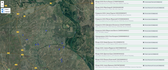
Subsidies are issued for growing particular crops, constructing greenhouses or installing irrigation systems. They are numerous and in-person inspections would require large teams of government officials. Furthermore, it is very time-consuming to check the whole field, which can be tens or hundreds of hectares in size. Using our system, verifications are done remotely, using satellite image processing coupled with advanced machine learning algorithms.
Similar technology is employed for detection of illegal activities. Traditionally, farmers had often burnt crop residues on their fields to save time and fuel needed for ploughing. This practice was abandoned in the past decades and was declared illegal, as it poses danger to humans and the environment. Also, there have been instances of occupation of state-owned farmland without bidding and paying for the rent. These and other offences are detected using satellite technology and have decreased in occurrence, thus securing safer and more eco-friendly farming, as well as higher revenues for the government.
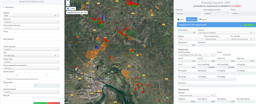
Other services include systems set up for various other public stakeholders, most notably for extension services. Extension services give advisory support to farmers and collect large amounts of field data. A dedicated platform based on AgroSense was set up where all the data is stored and visualised using a GIS engine. In this way, thousands of new records, as well as the historical database of field observation were digitised and gathered under one roof.