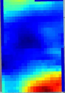
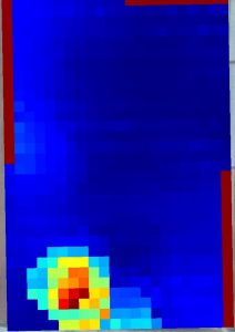
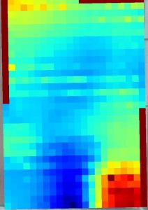
Geospatial data analytics
Big data analytics is based on heterogeneous data sources coming at different velocity and at a different resolution. Besides satellite images, BioSense’s AI group uses probes for soil electrical conductivity, handheld devices and information coming from agricultural machinery. Electrical conductivity of the soil is an excellent indicator of soil texture, compaction and chemical content and these parameters are scanned at various depths, depending on the setup and the plants of interest. Elevation maps are not less important, as they determine the flow of nutrients and often correspond to the yield, while the handheld devices, such as the BioSense’s Plant-O-Meter, are allowing for continuous growth monitoring.
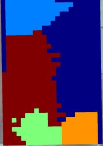
Using the techniques of data fusion, heterogeneous data are aggregated into a single dataset and used for the delineation of management zones. Zone delineation is done by applying clusterization algorithms on data, either in normalised or weighted form, depending on the relative importance of input features. These management zones have different properties between one another, but soil can be considered homogeneous within each of them. This allows for issuing recommendations concerning agricultural production separately for each zone, depending on its specifics. Such localised decision-making is the essence of the precision agriculture and it is also a necessary first step in determining the optimal sensor locations, which maximise their effectiveness.